The Best Activities in Singapore City
Between air-conditioned malls and spotless streets, it can be easy to forget that Singapore is also a place of wetlands, secondary forests, and repurposed infrastructure. These activities keep you outside, on foot or on the water, and in contact with the island’s ecosystems and layered history, while still fitting into a mostly car-light trip.
Courtesy of Gardens by the Bay, Henderson Waves, TreeTop Walk, and The Rail Corridor.
Gardens by the Bay
Best for: Seeing green infrastructure at the city scale
Neighborhood: Marina Bay
North Stars:


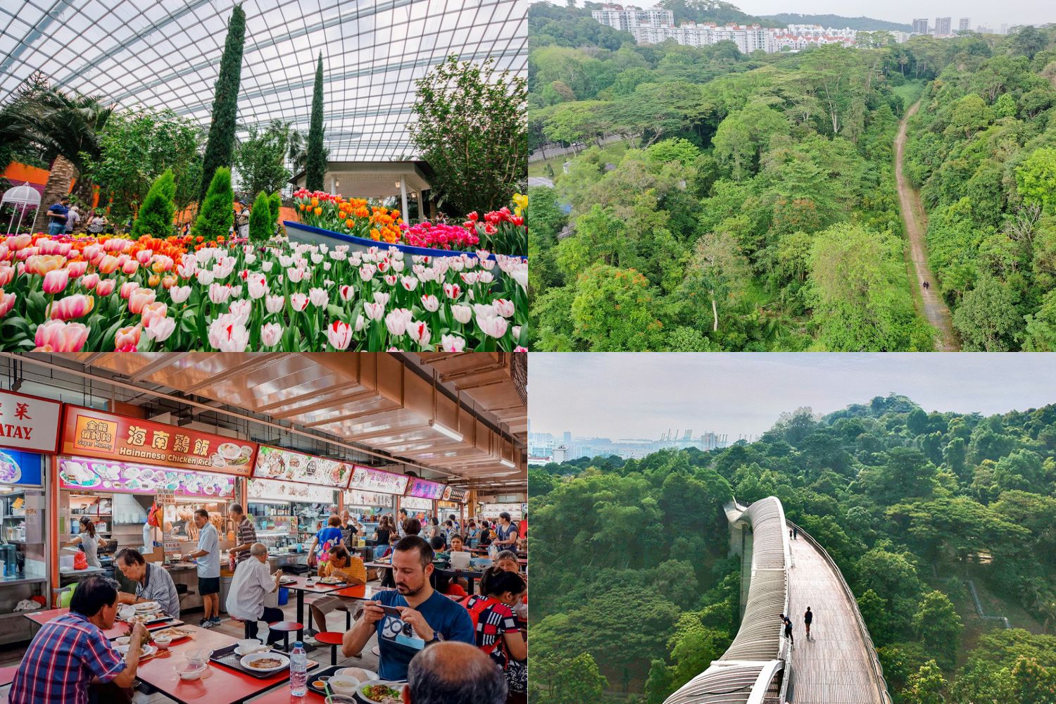
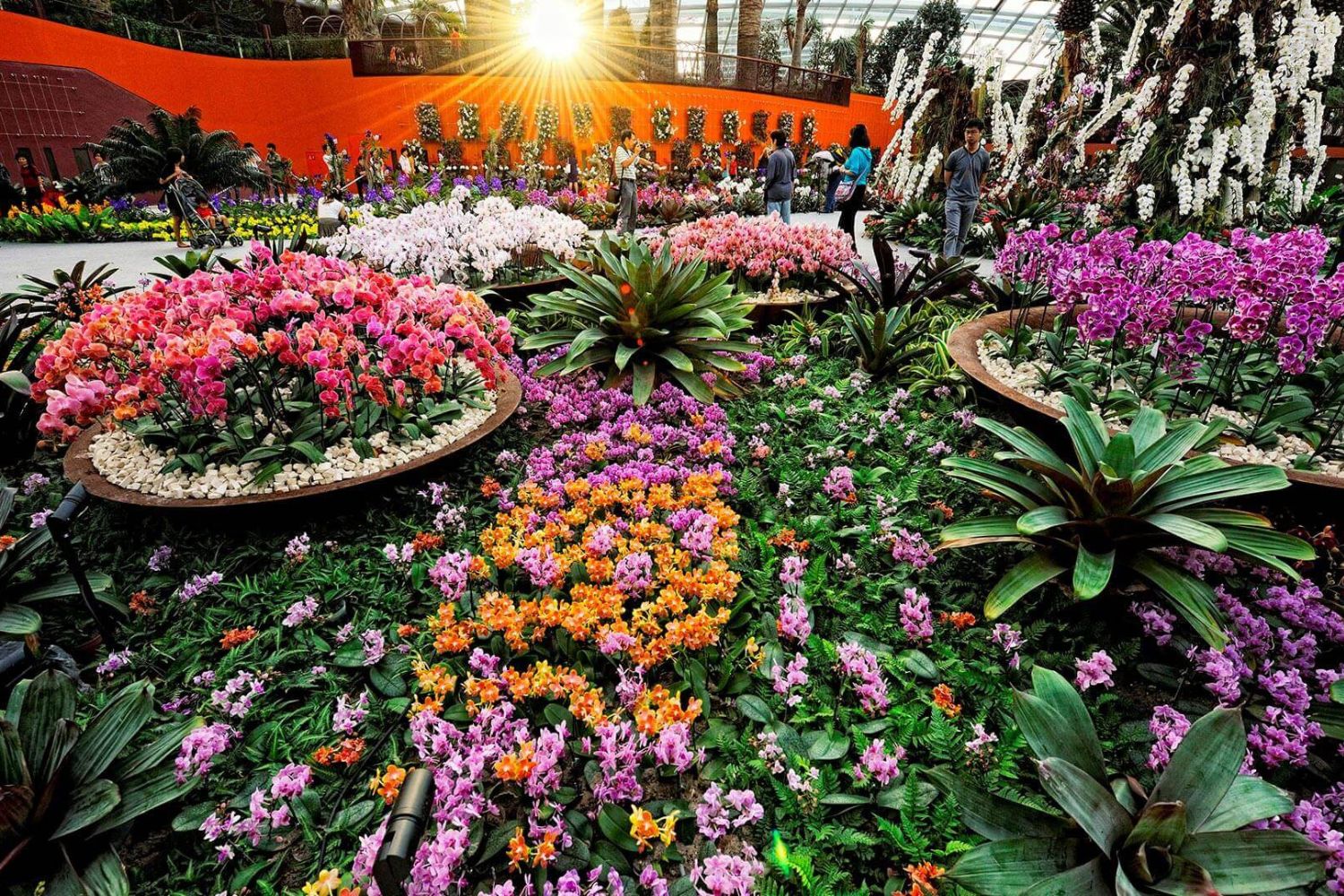
Across the bay from the CBD, Gardens by the Bay turns former waterfront land into 105 hectares of lakes, Supertrees, and two vast cooled conservatories that act as a climate experiment under glass. Inside, the Flower Dome and Cloud Forest use high-performance glass, shading systems, and efficient chillers to keep Mediterranean and montane plants comfortable in tropical heat, while elevated walkways and an indoor waterfall pull you up into the canopy. Outside, lakeside paths, themed gardens, and the Supertree Grove give you plenty of room to wander, with skyline views that remind you exactly how close the high-rises still are.
Flower Dome. Courtesy of Gardens by the Bay.
Sungei Buloh Wetland Reserve
Best for: Mangroves, migratory birds, and a different kind of skyline
Neighborhood: Northwest Singapore
North Stars:

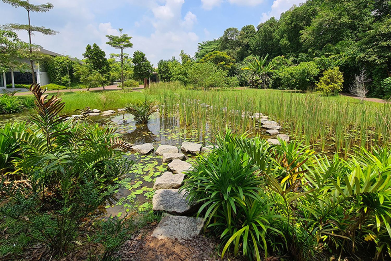
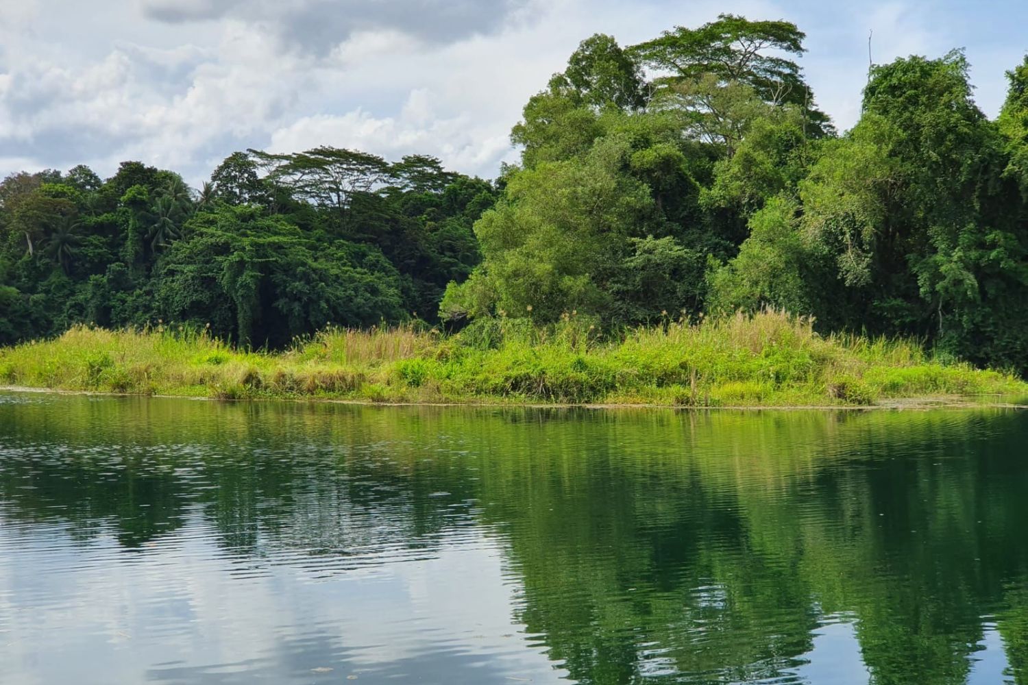
On the northwestern shore facing Johor, Sungei Buloh Wetland Reserve protects mangroves, mudflats, and ponds across more than 200 hectares, and serves as Singapore’s first ASEAN Heritage Park and a key stop on the East Asian–Australasian Flyway. Boardwalks and hides bring you close to herons, egrets, kingfishers, and seasonal shorebirds, with interpretive signs explaining how wetlands filter water, buffer coasts, and store carbon-rich sediments. Go early, carry water, and expect to leave with shoes a little dusty and a much clearer sense of how wild the island can still feel.
Nature walks. Courtesy of Sungei Buloh Wetland Reserve.
Pulau Ubin & Chek Jawa
Best for: A day trip that feels like stepping back in time
Neighborhood: Northeast, off Changi
North Stars:


From Changi Point Ferry Terminal, small bumboats ferry you across to Pulau Ubin, where kampong houses, shrines, and old quarries replace expressways. Renting a bicycle makes it easy to follow narrow roads and forest tracks out to Chek Jawa Wetlands, where coastal and mangrove boardwalks loop over seagrass beds and tidal flats, with lookout towers and simple shelters along the way. Plan around low tide if you can, eat at one of the basic seafood places near the jetty, and you have a full day that runs on public transport, small boats, and pedal power.
Pekan quarry floating wetlands. Courtesy of Pulau Ubin.
The Rail Corridor
Best for: Long urban walks with minimal road crossings
Neighborhood: Runs north–south through the island
North Stars:
Following the former KTM railway line, The Rail Corridor strings together roughly 24 kilometers of continuous green trail from the north of the island toward the old Tanjong Pagar station. Restored bridges, old station buildings, and informational panels keep its rail history visible, while plantings and porous paths turn it into an ecological corridor for birds and small mammals. You can hop on and off at multiple access points, using the MRT to connect sections, which makes it one of the easiest ways to experience Singapore at a walking pace without constantly crossing roads.
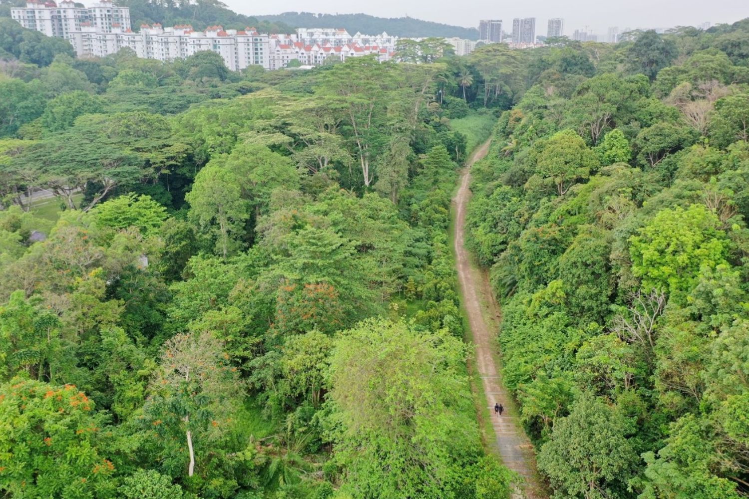
Aerial view. Courtesy of The Rail Corridor.
New Bahru
Best for: Creative spaces in a reimagined school complex
Neighborhood: River Valley / Outram
North Stars:


On the grounds of the former Nan Chiau High School, New Bahru gathers food, fashion, design, and wellness brands into a low-rise cluster that still feels like a campus. Corridors, staircases, and the old hall have been kept and restored, while classrooms now house bakeries, studios, galleries, and boutiques run by homegrown names. Many tenants work with some mix of slower production, local sourcing, or heritage craft, so wandering from room to room becomes a way to see how Singapore’s creative community is thinking about consumption, culture, and reuse.
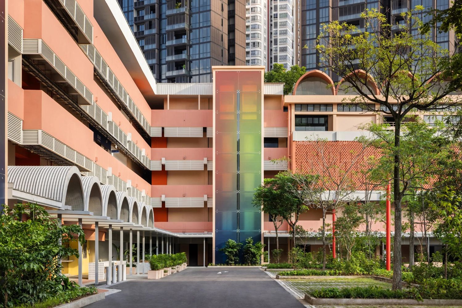
Outer view. Courtesy of Finbarr Fallon, New Bahru.
The Southern Ridges & Henderson Waves
Best for: Elevated walks with long views and linked parks
Neighborhood: Southern Singapore (Mount Faber / Telok Blangah / Kent Ridge)
North Stars:
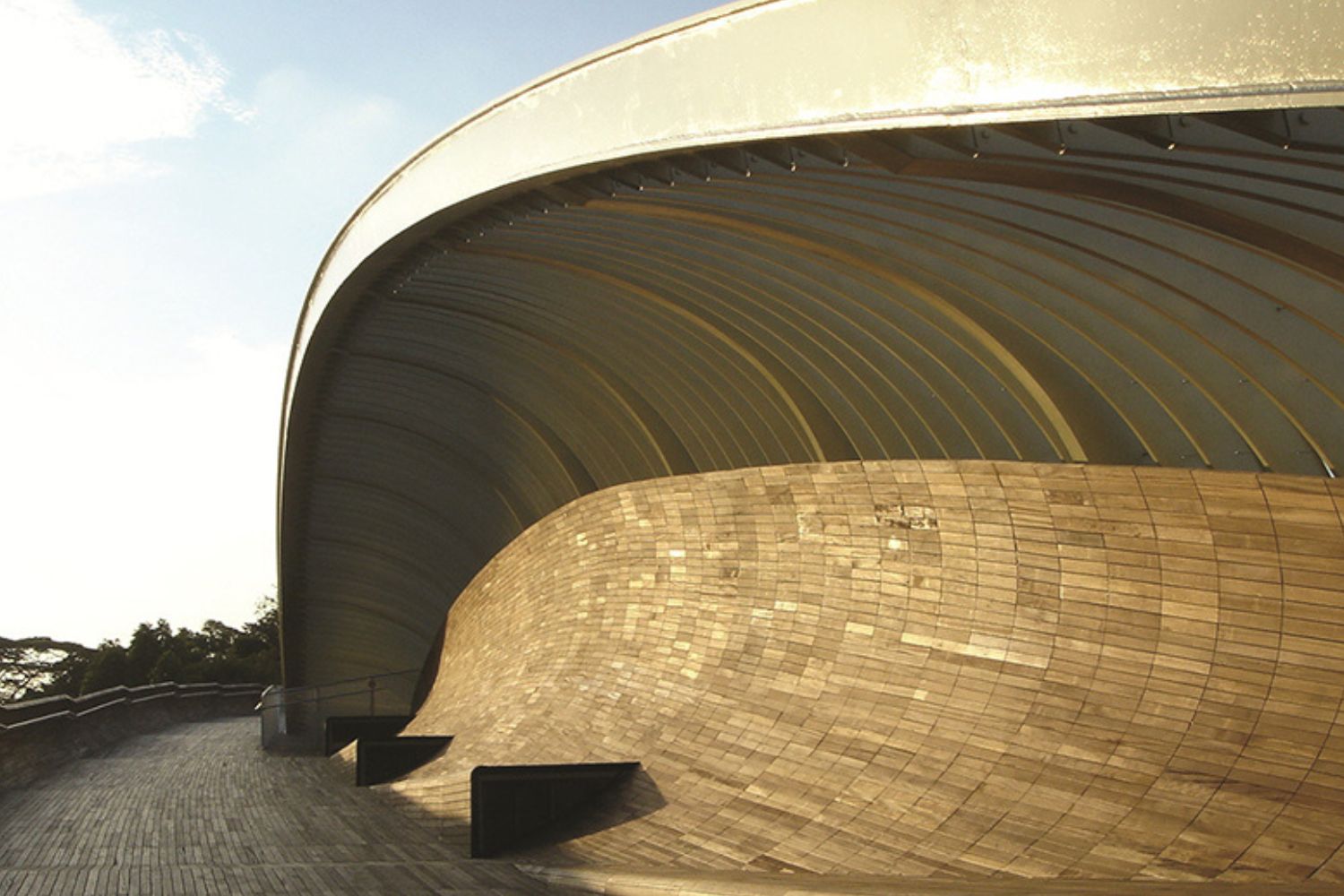
Running for about 10 kilometers across the hills of southern Singapore, the Southern Ridges connect Mount Faber, Telok Blangah Hill Park, and Kent Ridge Park with forest walks, canopy paths, and pedestrian bridges. The standout is Henderson Waves, a 274-meter timber-decked bridge that rises high above the road in a series of curved “ribs,” linking two hilltop parks and giving you views toward the port and islands. You can start from HarbourFront MRT, follow the signs through the ridge, and finish in HortPark or Kent Ridge, spending most of the day in shade and greenery instead of traffic.
Scenic view. Courtesy of Henderson Waves.
MacRitchie Reservoir & TreeTop Walk
Best for: Half-day hikes and canopy views
Neighborhood: Central Catchment
North Stars:
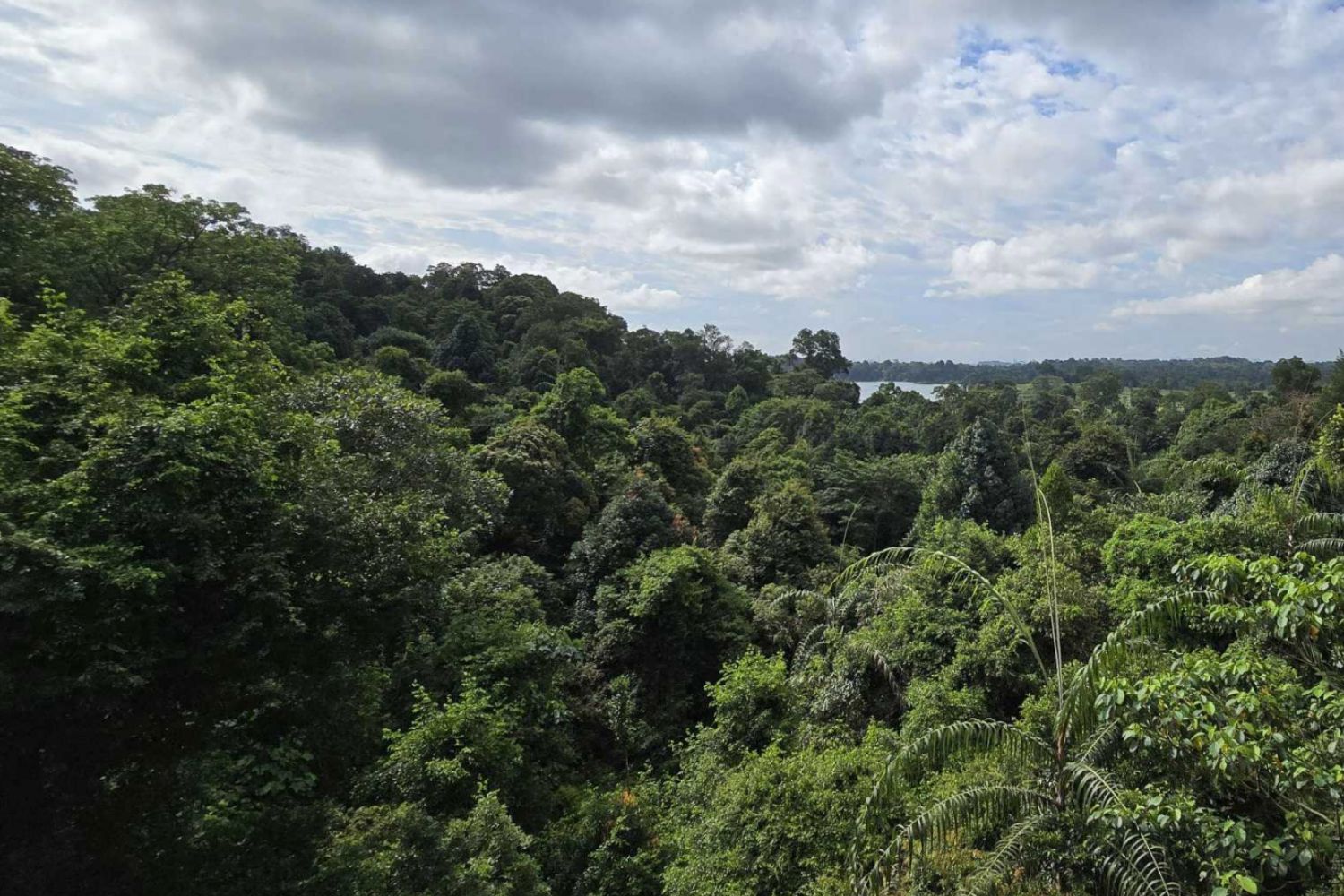
At the edge of the Central Catchment Nature Reserve, MacRitchie Reservoir anchors more than 20 kilometers of nature trails and boardwalks that loop through mature forest and along the water’s edge. The highlight is the TreeTop Walk, a 250-meter freestanding suspension bridge between two hilltops that gives you a bird’s-eye view of the forest canopy and the reservoir below. Routes range from short one-hour loops to half-day hikes, so you can pick a trail that matches your energy, refill your bottle at park taps, and still be back in town for dinner.